Showing posts with label historic Scotland. Show all posts

Tuesday, 22 April 2014

Stones, standing and in circles! (A to Z challenge)

Follow the forest track
Arran is absolutely full of standing stones, circles and ancient stone crypts to the point that many are not marked or even noticed in everyday life.  So I decided to show you one that you may not visit, preferring to go to the larger and I have to say higher up on the reward for effort scale! At the top of the Brodick to Lamlash Road there is a car park marked Dun Fion, walking from that taking the right hand track a small sign can be found on the left to note  at this point there is an overgrown burial cairn, but go further down the steep, slippy slope and through the forest trees to a little clearing and you will find this single stone and another cairn (also overgrown), not much to see but quite a mystical place – and remember originally the forest would not have been here so the views would have been right across Lamlash Bay.
Sign at side of track where overgrown Dunan Mor Cairn can be found
If you do visit this one don’t miss out the little stone circle near the carpark!
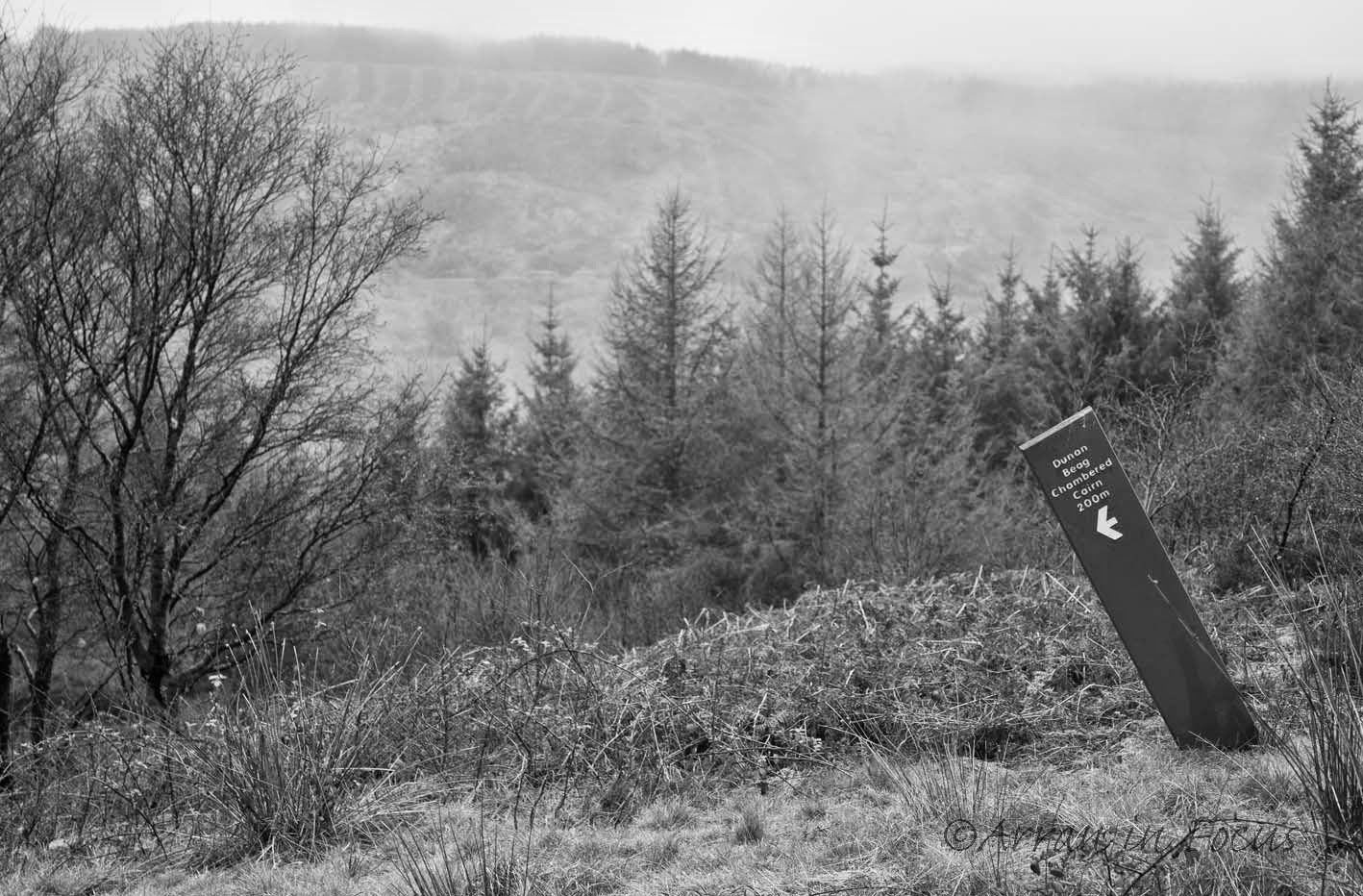
Beyond the the cairn is a further sign heading towards Dunan Beag Cairn - fittingly slanting downwards as the slope is steep and slippy.
However I do feel I should mention some of the more famous sites such as the big standing stones on Machrie Moor where there are also at least 6 circles. Nearby is the circle at Auchagallon, not to mention the Druid stone, also at Machrie near to the Olde Byre visitor centre.  But in Brodick an unmarked stone sits at the end of the driveway to the Big Wooden House and easily goes unnoticed, as do many in the fields along the Brodick Castle driveway.
Small standing stone near the Dunan Beag cairn.
An interesting stone can be found in the forest at Stonach, where rare cup and ring markings are etched into a large slab. In Whiting Bay, a walk up the hill at Glenashdale brings you to the Giants Graves, and I could go on and on, naming different points of interest. 


Saturday, 12 April 2014

Kings Cave (A to Z challenge)

Kings cave is a group of caves that are accessible to most visitors to the Isle of Arran.  They are just north of Blackwaterfoot where there is a forestry commission car park. The caves are formed from sandstone and are steeped in history with associations to Robert the Bruce and Irish hero Fionn. Over time the cave has been used as shelter, worship and even a school.  Modern graffiti now mixes with old historic markings.

Some carvings date back many centuries, possibly even to bronze age (Machrie Moor stones are about 1 mile away) and have been worn away or overlaid by both more recent carvings and mineral deposits. A good list of the ancient carvings can be found on one of my previous blogs.

To find all the markings, a good torch is needed to light the deepest recesses of the fork, found at the back of the cave.  And don’t forget to explore the little channels and other caves around.

Friday, 11 April 2014

J is for Jurassic (A to Z challenge)

Say Jurassic and we think dinosaurs, right? And although they may not be around now, there is plenty of evidence on the Isle of Arran to prove they once roamed the land.  Ok, so maybe it’s a long time ago (230 million years) when the isle was connected to a greater land mass but they were here.
Dinosaur footprints
Footprints have been found on numerous sites that are thought to have belonged to lizard like dinosaurs, about 12 feet long, and David Attenborough visited to film a documentary that covered a series of giant millipede tracks (from an earlier period) on the North of the island. And by ‘giant’ I mean the tracks are over a foot wide!
Single large footprint

Surprisingly, I don’t know of any bones that have been found but as the footprints were only found in the last 10 years there is plenty of time for them to be discovered.

Friday, 27 September 2013

The Outer Hebrides - Part 1

In September I visited the Outer Hebrides or Western Isles as they are sometimes known.  I had always wanted to visit these remote islands but never got round to it, so early in the year I made my plans and kept my fingers crossed for the weather.
Ullapool harbour
The islands cover quite a large area and it’s about 130 miles from top to bottom. Split into islands, some joined by causeways and others requiring a ferry trip.  The large majority of the islands are small and uninhabited, including St Kilda’s which is the most remote point of the UK and can be reached by boat trip from here.
The sun shone as we left Ullapool
The islands I visited were the Isle of Lewis, Isle of Harris, North Uist, Benbecula and South Uist. My journey started by leaving the Isle of Arran on the Lochranza to Claonaig ferry and travelling north to Ullapool; stopping overnight in a little dog friendly motel in readiness for the morning ferry across to Stornaway. This is a lovely fishing town with pretty harbour and I regretted not stopping here for an extra day to take in the views.
In the morning the sun shone, the sky was blue and the sea calm for crossing the ‘Minch’.  The ferry takes nearly 3 hours, so plenty of time for a walk around the decks taking in the views. I used a Calmac Hopscotchticket as it works out quite a lot cheaper than booking single journeys. 
Sunset promise
On arriving in Stornaway, I was initially surprised at how big it was, but then there is no easy access to the mainland and the bulk of the population live here.  The combined population of Lewis and Harris is about 20k. Not stopping I pushed on to my first destination travelling across the Isle of Lewis on a single track road to the rugged west coast and the little village of Gearrannan. This really is remote Scotland and I was glad to be well prepared and have all my supplies with me.
Gearrannan blackhouse village
Gearrannan village has been modernised and now has traditional black houses converted into holiday homes, beautifully done, with under floor heating and simple kitchens.  There is also a small hostel. The stone houses are constructed of double stone walls and a thatch roof.  All very eco friendly and more importantly cosy.
My self catering blackhouse - home for a few days
Thatch roof - rabbits ran along the grass edges!
The economy of the island is based on crofting, fishing, weaving and tourism. The most famous destination of the Isle of Lewis being the Callanish stones.  These date from about 2900 BC and are quite spectacular.  There are actually 3 circles, 2 smaller ones being about 2km away but still easily accessible.  The dank grey day did little to encourage photography, but as any traveller knows you have to make the best of the conditions when staying for short periods in any place.  An early start avoided other tourists to ensure clean shots.
Callanish stones
 
Callanish stone
Another place to visit is the Butt of Lewis, supposedly the windiest place in the UK; where fish can be blown onto the dunes in high winds – well not on the day I went.  All was calm!
Coastal views 
The weather brightened and the next two days provided coastal walks with views and lots of opportunity for landscape photography.  The evening sunsets showed promise although they never came to full fruition and it was way past my G & T time before it was really going dark!

Blue calm
I was very sorry to leave this little oasis and I’m sure I’ll be back as I really didn’t get to see everything I wanted.
More sunset promise

Wednesday, 10 April 2013

Ancient historical carvings on Arran

Some of the rings

Arran is seeped in history and I've previously done a blog on the carvings at Kings Cave which proved popular so here's another site that is less well known.  Just outside of Brodick near the start of the string road I've seen the cups and rings marked on the map and heard the odd mention of them but despite driving past the area most days there is no sign post, unlike other historical sites on Arran.  

More of the rings and a cup
So it wasn't with much expectation that I set out on a rainy day to see if I could find them (yes it was a few weeks ago, as we've not had rain for ages, and then I got distracted and did a blog on the snow).

This figure appears to walk with sticks
I had a map location but nothing more, the track is off the String Road on the left, not long after passing the grave yard.  Twenty yards up the track there is space for 2 – 3 cars to park before a barrier and I continued on foot.  Eyes peeled for anything that may look interesting I continued along the churned up muddy track for about ¼ mile.  The track turns to a small path and within 30 yards the flat stone is reached.

Is this a person with a horse (similar to Kings Caves)?

No fear of missing it, its huge! About 25 foot by 12 foot or more, some of the carvings are several feet tall.  The rock slab is in two main parts both covered in carvings, too many to describe and show photographs of, so only a few to give a taste of the site are shown.

The cups - are these indentations where tools were sharpened?
Although it is difficult to imagine the carvings were done well before the forestry arrived and they actually stand on Stronach Ridge, with views that would have been across the Beinn Nuis and the Goatfell range.

There is something a little phallic about these!

There are several guesses as to the relevance of the carvings, from sun dials to maps and it is believed they originate in the Bronze Age (c 4000 years ago).

This bird like carving is on the side of the rock and previously was covered with vegetation

They are described as cups and rings, but some look like people, and some that have only recently started to be described in texts, are like birds.  I found one that looks like a foot long dragonfly – and I can’t find this described anywhere else, so maybe its recently been uncovered; it is clear that the ground has had some clearance work done.
My 'dragonfly' 

 There even seems to be some rune or Pictish like markings towards the left side of the main rock slab.

Are these Pictish markings?

The carvings were recorded in great detail by Coles in 1901 with descriptions, drawings and some photographic plates (no trees in these!) but there are areas which were still filled with peat and vegetation.  Some of this has now been removed revealing the birds and other carvings.  This description also notes two other carved rocks a short distance away but these are now well under forest plantation.

To me this looks like a row of people, including a horse.

This is a great place to go when its wet as the water highlights the marks (but still easily seen when dry), if visiting in summer take midge repellent, and stick to the path during the stalking season!

The main slab
I have doubts on these which have recently been uncovered - are they Iron Age graffiti? 
There are no preservation measures in place for the rocks, or definitive answers to what they are, so use your imagination and leave the site as you find it.

Saturday, 9 March 2013

Kilwinning Abbey

Kilwinning Abbey Ruins

 Well last week I found myself having to kill a few hours while I waited for my car to be mended at the garage in Kilwinning, just across the water from our lovely Isle of Arran.  ‘Killing time’, now that phrase sort of highlighted how many towns around this part of Scotland start with ‘Kil’.  I was in Kilwinning, then there’s Kilmarnock, Kilbride, Kilbirnie, to name a few.  The name ‘Kil’ links back to the Celtic Church, so there was no surprise to find that Kilwinning has an old Abbey. The ‘winning’ part is believed to have been taken from the name of a preacher, Winin, from the 6th century, who built a church here and was later canonised.

Stone arches are a major feature of the remains
Despite the dull, wet and grey weather, old buildings can be great subjects for photography and so I went off in search of some inspiration.
Decorative window arches
The Abbey has a fascinating history directly linked to the first war for Scottish Independence. Bernard Linton, the Abbot of Kilwinning is credited with writing the Declaration of Arbroath (the first statement of nationhood in history).  He died in 1331 and is buried in a vault under the ruins.

“For we fight, not for glory, nor for riches, nor for honour,
but only and alone for freedom, 
which no good man gives up but with his life"

Detail remains in the stonework

The vaults under the abbey ruins are no longer accessible due to the rebuilding and extension the current Parish Church.  Occasionally archaeological digs still take place.
The new tower - built 1814
The original Abbey had three steeples, two were destroyed during the Reformation and the third by lightening 200 years later.  However, a new tower, known as the Clock tower was built between 1814 – 1816 (at a cost of £1590).  This tower was refurbished by the District Council in 1995 and is now open to visitors at limited times during the summer.  It is even possible to climb the 143 steps to the roof of the tower for great views of Ayrshire (on a fine day).  Needless to say the tower was firmly shut during my visit!


Also of interest to historians (but not photographed) is the ‘Head lodge of Scotland’.  Built in 1140, around the same time as the Abbey, this Lodge was given the number ‘0’.  The Lodge is just round the corner from the Abbey on Main Street.


A more spooky image....